Category:Old maps of Indonesia
Jump to navigation
Jump to search
Countries of Asia: Afghanistan · Armenia‡ · Azerbaijan‡ · Bahrain · Bangladesh · Bhutan · Brunei · Cambodia · People's Republic of China · Cyprus‡ · East Timor · Egypt‡ · Georgia‡ · India · Indonesia‡ · Iran · Iraq · Israel · Japan · Jordan · Kazakhstan‡ · Kuwait · Kyrgyzstan · Laos · Lebanon · Malaysia · Maldives · Mongolia · Myanmar · Nepal · Oman · Pakistan · Philippines · Qatar · Russia‡ · Saudi Arabia · Singapore · Sri Lanka · Syria · Tajikistan · Thailand · Turkey‡ · Turkmenistan · United Arab Emirates · Uzbekistan · Vietnam · Yemen
Limited recognition: Taiwan · State of Palestine – Other territories: Hong Kong · Macau
‡: partly located in Asia
Limited recognition: Taiwan · State of Palestine – Other territories: Hong Kong · Macau
‡: partly located in Asia
Countries of Oceania: Australia · Fiji · Federated States of Micronesia · Kiribati · Marshall Islands · Nauru · New Zealand · Palau · Papua New Guinea · Samoa · Solomon Islands · Tonga · Tuvalu · Vanuatu
Other areas: Clipperton Island · Cook Islands · French Polynesia · Guam · Hawaii · New Caledonia · Niue · Northern Mariana Islands · Pitcairn Islands · Wallis and Futuna – Partly: British overseas territories · Indonesia · French Southern and Antarctic Lands
Other areas: Clipperton Island · Cook Islands · French Polynesia · Guam · Hawaii · New Caledonia · Niue · Northern Mariana Islands · Pitcairn Islands · Wallis and Futuna – Partly: British overseas territories · Indonesia · French Southern and Antarctic Lands
| NO WIKIDATA ID FOUND! Search for Old maps of Indonesia on Wikidata | |
| Upload media |
Many in Category:Old maps of Southeast Asia also depicts Indonesia. Some files there might not be categorized in this category yet.
Use the appropriate category for maps showing all or a large part of Indonesia. See subcategories for smaller areas:
| If the map shows | Category to use |
|---|---|
| Indonesia on a recently created map | Category:Maps of Indonesia or its subcategories |
| Indonesia on a map created more than 70 years ago | Category:Old maps of Indonesia or its subcategories |
| the history of Indonesia on a recently created map | Category:Maps of the history of Indonesia or its subcategories |
| the history of Indonesia on a map created more than 70 years ago | Category:Old maps of the history of Indonesia or its subcategories |
Subcategories
This category has the following 10 subcategories, out of 10 total.
Media in category "Old maps of Indonesia"
The following 41 files are in this category, out of 41 total.
-
Admiralty Chart No 2160 Carimata Strait, Published 1881.jpg 10,934 × 16,289; 46.48 MB
-
AMH-5241-NA Map of Java's north coast, from Poelo Mandelique to Petjarang.jpg 2,400 × 1,535; 612 KB
-
AMH-5316-NA Map of Seram and the region south east of Seram.jpg 2,400 × 1,681; 507 KB
-
AMH-5534-NA Map of the northern coast of Java.jpg 2,400 × 1,648; 642 KB
-
AMH-5538-NA Map of the smaller Soenda islands.jpg 2,400 × 1,722; 682 KB
-
AMH-5541-NA Map of the south eastern islands.jpg 2,400 × 1,611; 457 KB
-
Carte du Grand Archipel d'Asie (Partie Nord-ouest de l'Océanie).tif 6,648 × 4,855; 92.34 MB
-
Chart of the Malay Archipelago Dutch discoveries in Australia 1618.jpg 3,600 × 4,971; 3.75 MB
-
Krt 1510 full.jpg 4,000 × 3,000; 14.13 MB
-
P038 - N° 528. Indonésie (ouest). - Liv4-Ch05.png 1,433 × 1,871; 390 KB
-
P039 - N° 529. Indonésie (est). - Liv4-Ch05.png 1,446 × 2,006; 384 KB
-
Peta Relif Pulau Kalimantan (Borneo).jpg 870 × 967; 1.47 MB
-
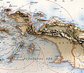
Peta Relif Pulau Papua.jpg 974 × 841; 1.38 MB
-
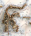
Peta Relif Pulau Sulawesi.jpg 624 × 717; 805 KB
-
Peta Relif Pulau Sumatera (cropped).jpg 984 × 1,167; 1.83 MB
-
Seconde partie de la carte d'Asie.tif 9,783 × 6,768; 189.43 MB
-
Topographische kaart der afdeelingen Pasoeroean.jpg 6,940 × 8,159; 8.7 MB

.jpg/74px-134_of_%27La_Terre-_description_des_phénomènes_de_la_vie_du_globe._I._Les_Continents._II._L%27Ocean%2C_l%27Atmosphere%2C_la_Vie%27_(11085393313).jpg)
.jpg/76px-346_of_%27Sailing_Directions_for_the_English_Channel._Part_I._The_South_coast_of_England_..._Part_II._The_North_coast_of_France%27_(11190567864).jpg)
.jpg/120px-39_of_%27Geschiedenis_van_den_Atjeh-oorlog%2C_1873-1886._In_populairen_vorm_verteld%27_(11185102243).jpg)
.jpg/69px-436_of_%27Travels_in_the_East_Indian_Archipelago_..._With_maps_and_illustrations%27_(11084763763).jpg)
.jpg/70px-437_of_%27Travels_in_the_East_Indian_Archipelago_..._With_maps_and_illustrations%27_(11085399596).jpg)
.jpg/120px-619_of_%27Travels_in_the_East_Indian_Archipelago_..._With_maps_and_illustrations%27_(11087671076).jpg)


.tif/lossy-page1-120px-Carte_du_Grand_Archipel_d%27Asie_(Partie_Nord-ouest_de_l%27Océanie).tif.jpg)


._-_Liv4-Ch05.png/92px-P038_-_N°_528._Indonésie_(ouest)._-_Liv4-Ch05.png)
._-_Liv4-Ch05.png/86px-P039_-_N°_529._Indonésie_(est)._-_Liv4-Ch05.png)
.jpg/108px-Peta_Relif_Pulau_Kalimantan_(Borneo).jpg)


.jpg/101px-Peta_Relif_Pulau_Sumatera_(cropped).jpg)

